Better information can lead to smarter decision-making. While a GIS doesn’t make decisions for you, it does support the decision-making process by providing you with a set of handy tools and resources that empower you to make better decisions using attribute data.
The unbounded abilities of GIS, together with the potential its union with data analytics presents, have helped businesses save millions of dollars. The widespread usage of GIS (geographic information system) software across several core industry applications has enabled organisations to integrate hardware, software, and data. This integration helps capture, manage, analyse, and visualise any geographically referenced information. Understanding the components of GIS—which include hardware, software, data, methods, and people—is essential for making the most of this powerful technology.
The applications of GIS (geographic information system) are incredibly diverse and can include everything from urban planning to environmental monitoring. Today, domains like law enforcement, agriculture, meteorology, and disaster management are leveraging the power of GIS. Before we go any further, it is crucial to look at the core GIS components and its applications.
This guide breaks down the five essential components of GIS and, through practical examples, shows how they work together to turn raw data into intelligent, actionable insights.
What Are the components of GIS (geographic information system)
Here’s looking at the five essential components of GIS that comprise its fundamental framework: hardware, software, data, methods, and people. Together, these basic components of GIS create the foundation based on which businesses and users can effectively analyse and visualise geospatial data to address a wide range of challenges and make intelligent decisions.
- Hardware
- Software
- Data Management
- Methods
- People
- People: A GIS Analyst is tasked with finding the most fuel-efficient route.
- Data: They use spatial data (road networks, traffic patterns, elevation) and non-spatial data (vehicle fuel capacity).
- Hardware: They use a powerful workstation to process the large datasets.
- Software: They use a GIS application (like ArcGIS Pro) to run the analysis.
- Methods: The software uses a "network analysis" algorithm that calculates the optimal path based on all the data inputs. The result is a dynamic map showing the most efficient route, saving the company time and money.
- Improve Operational Efficiency: Optimize logistics, manage assets, and streamline field operations.
- Enhance Decision-Making: Visualize complex data to make smarter choices about site selection, resource allocation, and market analysis.
- Mitigate Risk: Analyze environmental risks, model disaster scenarios, and improve emergency response planning.
- Increase Profitability: By improving efficiency and enabling smarter decisions, a robust GIS delivers a strong return on investment.
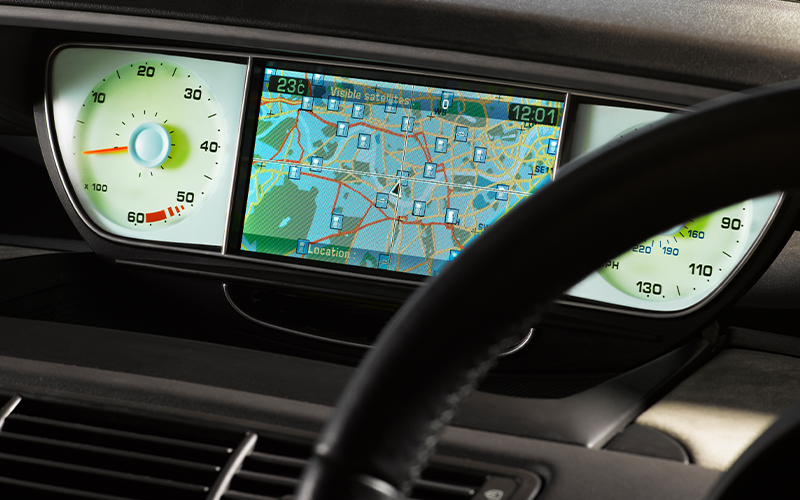
Any device (a computer, a smartphone, a tablet, a laptop, desktop, a monitor, a printer, a scanner, etc.) can be used to access (geographic information system) GIS applications that stores large GIS datasets, GIS software, and applications can be referred to as the hardware. Typically, these are GIS workstations with powerful processing capacity, huge monitors, high-speed connectivity, and ample disk space for data storage.
Any program, software package, application, or solution (free or commercial) that enables a GIS user to perform essential GIS functions is called the software component. GIS programs, database management systems, and graphical user interface (GUI) apps enable users to manipulate, store, query, and analyse spatial and non-spatial data and information.
Any spatial or non-spatial information stored digitally in computers or servers can be referred to as GIS data. Such data is gathered using data collection technologies such as geospatial remote sensors and stored in a digital format for GIS applications users. While this process can be done in-house, some organisations prefer liaising with third-party commercial data providers or vendors for their data needs. A GIS solution helps users make sense of the data collected, and then organise it, analyse it, and use data visualisation tools to present it in the form of a map, a graph, or other informative graphics.
An integral part of the GIS framework is the various techniques used to turn data into digestible and actionable information. This component includes the spatial analysis techniques—algorithms, statistics, and models—that are predefined or custom-built for a business. These methods are the "brains" of the operation, forming a crucial part of the GIS workflow that calculates optimal routes, identifies market gaps, or assesses environmental risk, ensuring the final output is not just data, but a solution.

How the Components of GIS Work Together: A Practical Example
These components are not independent; they work together as an integrated system. Consider a logistics company planning a new delivery route:
The Business Value: Why GIS Components Matter for Your Organization
For organizations, understanding the components of GIS is not just a technical exercise; it's a strategic one. A well-integrated GIS enables you to:
Anyone who uses a GIS (geographic information system) falls system under this category. This refers to the GIS professionals using dedicated GIS solutions or the general public accessing a digital map. It is the professionals who keep innovating and pushing the limits of what is possible in the GIS landscape in order to serve their businesses and general users better. GIS is used in almost every major industry and generates employment opportunities for a wide range of professionals, including data analysts, analytics professionals, and technical specialists who design and monitor GIS (geographic information system) applications.
For organisations on the digital transformation journey, agility is key in responding to a rapidly changing technology and business landscape. Now more than ever, it is crucial to deliver and exceed on organisational expectations with a robust digital mindset backed by innovation. Enabling businesses to sense, learn, respond, and evolve like a living organism through the use of geographic data, will be imperative for business excellence going forward. A comprehensive yet modular suite of services is doing exactly that. Equipping organisations with intuitive decision-making automatically at scale, actionable insights based on real-time solutions, anytime/anywhere experience, and in-depth data visibility across functions leading to hyper-productivity, Live Enterprise is building connected organisations that are innovating collaboratively for the future.
How Infosys BPM Delivers Tangible ROI with Geospatial Services?
At Infosys BPM, we offer unrivalled expertise in geospatial technology with an array of focused GIS solutions. From mining and transport to utility and telecom, we have served several clients across industry sectors around the globe through the Infosys Global Delivery Model. Our geospatial data framework is designed to operate on a co-creation model, enabling us to deliver project-ready GIS that has the ability to cater to sudden demand peaks and solve your routine challenges.
Infosys BPM provides clients with an entire portfolio of GIS services, including data mapping, collection, gathering, storage, processing, integrating, management, analysis, and map data distribution. We have a proven GIS Centre of Excellence (CoE), which offers services such as:
- GIS Consulting Services
- Spatial Data Management
- Application Support and Maintenance
- Spatial Data Analysis
- Project/Program Management
Frequently Asked Questions (FAQ)
What is the difference between GIS and GPS?
This is a very common point of confusion. GPS (Global Positioning System) is a technology used to determine an exact location on Earth. It provides the "dot on the map." GIS (Geographic Information System) is the broader system used to capture, store, analyze, and visualize that location-based data. In simple terms, GPS is a data source, while GIS is the entire system that gives that data meaning and context.
What are some real-world examples of GIS being used by businesses today?
GIS is used across almost every industry. A few examples include:
- Retail: Using demographic and traffic data to determine the optimal location for a new store.
- Insurance: Analyzing geographic data to assess property risk from natural disasters like floods or wildfires.
- Logistics: Using real-time location data to optimize delivery routes and manage a fleet of vehicles.
- Utilities: Mapping out their network of pipes or power lines to manage maintenance and respond to outages.