


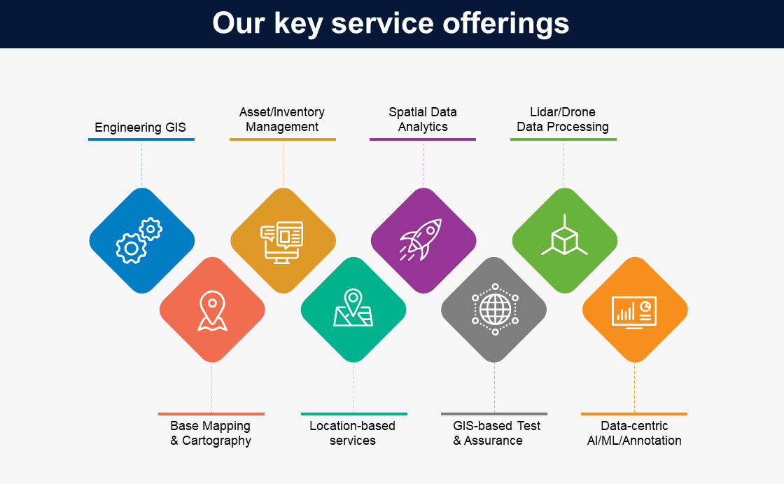
Geospatial data services
Infosys BPM geospatial data services help enterprises turn complex spatial data into faster, more confident operational decisions. Built on 20+ years of GIS delivery for utilities, oil and gas, telecom, mining, and transport leaders, our services span the full geospatial lifecycle, mapping, data capture, integration, spatial data management, analytics, and distribution, delivered through the proven Infosys Global Delivery Model.
Our project-ready GIS framework is purpose-built to absorb sudden demand surges and routine pressures across provisioning, outage response, field and fleet operations, disaster recovery, and data quality. The outcome for enterprise leaders is sharper asset visibility, optimized field and network operations, and faster response to outages, demand surges, and regulatory change
Infosys BPM has a proven GIS Centre of Excellence (CoE), which offers services such as:
GIS consulting services that help enterprises plan, implement, and optimize Geographic Information Systems aligned to specific industry priorities, from utility network design to telecom rollout and asset modernization.
Key components
- Assessment: Evaluate the client's current geospatial capabilities and identify areas for improvement.
- Strategic planning: Develop a roadmap for GIS integration aligned with the client's business objectives.
- Technology selection: Recommend appropriate GIS tools and platforms that fit the client's requirements.
- Implementation support: Provide assistance during the deployment of GIS solutions to ensure seamless integration.
End-to-end spatial data management, data digitization, migration, validation, governance, and integration, to maintain accurate, audit-ready geospatial datasets across asset, network, and field systems.
Key components
- Data collection and entry: Gather geospatial data from various sources and input it into the GIS system.
- Data cleaning and validation: Ensure the geospatial data is accurate and free from errors.
- Database management: Organize and store geospatial data efficiently for easy retrieval and analysis.
- Data integration: Combine geospatial data with other datasets to provide comprehensive insights.
24x7 application support and maintenance for enterprise GIS platforms, including upgrades, performance tuning, incident response, and platform modernization, so internal teams stay focused on business priorities.
Key components
- Technical support: Offer assistance to users encountering issues with GIS applications.
- System monitoring: Regularly check the health and performance of GIS applications to pre-emptively address potential problems.
- Updates and upgrades: Keep GIS applications up-to-date with the latest features and security patches.
- User training: Provide training sessions to help users effectively utilize GIS applications.
Spatial data analysis and location intelligence services that uncover patterns, predict outcomes, and translate geospatial data into board-level decisions, covering visualization, spatial modeling, trend analysis, and reporting.
Key components
- Data visualization: Create maps and other visual representations to illustrate geospatial data insights.
- Spatial modelling: Develop models to simulate real-world scenarios and predict future outcomes.
- Trend analysis: Examine geospatial data over time to identify significant changes and trends.
- Reporting: Generate comprehensive reports detailing the findings from spatial data analyses.
Geospatial project and program management, including turnkey delivery, governance, and risk management for large-scale GIS implementations, migrations, and modernization programs.
Key components
- Project planning: Define project scope, objectives, timelines, and resource requirements for successful GIS delivery.
- Risk management: Identify, assess, and mitigate risks across spatial data, technology, and delivery dimensions.
- Stakeholder coordination: Align internal teams, partners, and client stakeholders across the full program lifecycle.
- Performance monitoring: Track progress against milestones, manage delivery governance, and report on program health to leadership.
Our GIS Centre of Excellence delivers across the full enterprise geospatial technology stack, with deep platform expertise in:
- Esri ecosystem: ArcGIS Desktop, ArcGIS Enterprise, and partner solutions including Schneider ArcFM, Geocortex, Epoch Software, and Geofield
- Utility and asset platforms: GE Smallworld and G-Technology
- CAD and engineering: AutoCAD Map 3D
The core competency of Infosys BPM lies in delivering various asset management solutions pertaining to data digitisation, data creation, data migration, spatial modeling, and analytics.

AI and automation in geospatial workflows
Infosys BPM applies AI, machine learning, and intelligent automation across the geospatial lifecycle, reducing manual digitization effort, improving data quality, and shortening time-to-insight for utilities, telecom, energy, and asset-intensive enterprises.
Our GIS Centre of Excellence combines proven Esri and Smallworld engineering with AI-led accelerators that scale across large asset and network estates:
- Object-based vectorization: AI-assisted extraction of features from satellite imagery, drone captures, and scanned maps, accelerating large-scale data creation and migration programs.
- Automated data quality: ML-driven validation, anomaly detection, and reconciliation across distributed geospatial datasets.
- Predictive spatial analytics: Predictive spatial analytics: Pattern detection and forecasting to support outage prediction, demand planning, and field operations optimization.
- Workflow automation: Bots and intelligent workflows that reduce manual effort in spatial data management, application support, and reporting cycles.
The outcome is faster, more confident geospatial decisions at enterprise scale, with lower cost-to-serve and higher data integrity.
Insights


Why choose us for geospatial data services?
Infosys BPM geospatial data services are delivered by senior GIS domain experts with deep spatial technology backgrounds, equipped to address large-scale asset, network, and field operations challenges across industries.
Our co-creation model spans data, solutions, and integration, combined with intelligent automation that lowers IT cost, improves system availability, and strengthens data quality at scale.
How do we deliver value?
Infosys BPM addresses challenges from the clients and delivers processes and strategies in the geospatial ecosystem through:
- A global delivery network of 30,000+ associates across 10 locations, supporting enterprise geospatial programs at scale.
- 20+ years of geospatial domain expertise, industry experience, and applied innovation
- Long-term and sustainable model with leading navigation industries.
- Competence in working with all industry-standard data models across all phases including design, development, customisation, and implementation.
- Focused technology practices with a global delivery model, integrated domain excellence, and complete project turnkey solution and ownership.
- Specialized capability in spatial data migration, enterprise asset management, infrastructure modernization, and test automation.
- Industry collaboration and institutional partnerships to derive best practices.
Our geospatial data industrial offerings solutions


Expertise, innovation & experience
Success stories
Bringing values to businesses through our products and services

Case Study

Case Study

Case Study

Case Study
Challenges and solutions
Centralised GIS consulting, spatial data management, and spatial analysis services consolidate asset and network data from multiple sources into a single geospatial view, enabling faster planning, maintenance, and outage response.
Structured spatial data management services—including data collection, cleaning, validation, and integration—help maintain accurate, consistent geospatial datasets that can reliably support analytics, field operations, and regulatory reporting.
Application support, maintenance, and project/program management services provide ongoing technical support, monitoring, upgrades, and delivery governance so internal teams can focus on business priorities while GIS platforms and projects are run at scale.
Request for services
Find out more about how we can help your organization navigate its next. Let us know your areas of interest so that we can serve you better.

All the fields marked with * are required
