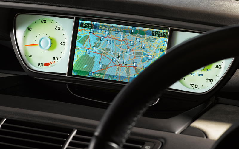
Understanding geospatial data
In the current scenario of post-Covid, there are significant volumes of systems and devices which went remote, due to the new working culture. On top of it, devices on IoT and social media are getting linked to the business and organisation to share or consume data.
Every organisation should have a clear idea of where their users are connected and who are vulnerable to cyber-attacks, including phishing, hacking, etc. So, organizations seek visual maps or location intelligence to identify their employees/users to know the intensity of threats.
This brings every organisation to leverage geospatial technology (GIS) platforms, with the help of map infrastructure, to be able to provide visual support to know the location of the users, and perhaps, origin of the hackers in case of attack.
GIS, through the physical network infrastructure strategy, is able to identify unusual activity or any attempts on any data breach. Therefore, cyber analyst can protect the infrastructure that holds the work that humansdo within the company and their data. That is, it’s meant to protect people.
In the world of espionage, satellite imagery, Geographic Information System (GIS) and Global Positioning System (GPS) aids are indispensable elements.
These elements offer a sneak peek into the expansive realm of geospatial (or simply, spatial) data—an intricate interplay of the ‘where’ (latitude and longitude for location), the ‘what more’ (attributes like names and elevation) and the ‘when’ (temporal information such as timestamps and lifespan) of any spot on Earth. They form the secret sauce for mapping, analysis and deciphering the ever-changing vibes of our planet.
Beyond location-sharing
Advanced technologies like GPS, GIS and remote sensing play a distinct role in gathering, processing and disseminating geospatial information across a range of applications that involve homogonous volume of data, at the same time, invites numerous threats that not only includes the local challenges but to an extent national security. A few examples of mission-critical GIS applications include the following:
- Disaster and exigency operations: During disasters, geospatial data helps assess the extent of damage, plan evacuation routes, and allocate resources efficiently. Mapping tools use geospatial data to provide real-time information, aiding decision making and coordination among response brigades.
- Environmental monitoring: Geospatial technology can track deforestation, changes in land cover, and the impact of climate change. Remote sensing technologies, such as satellite imagery, capture geospatial data for studying environmental trends, biodiversity, and the health of ecosystems.
- City planning: Urban and regional planners use geospatial data to make informed decisions about land use and development. This includes analysing population distribution, zoning regulations, infrastructure planning and identifying suitable areas for construction. Geospatial data contributes to sustainable and efficient urban development.
- Military operations: The military relies on geospatial data for mission planning, navigation, and situational awareness. Geospatial intelligence derived from satellite imagery and other sources aids in mapping terrains, identifying potential threats and planning strategic movements. Additionally, it plays a role in border surveillance and monitoring geopolitical developments.
What we saw above is just a teaser of the vast array of use cases for geospatial data. It is revolutionising industries dependent on up-to-date location information, including logistics, transportation, telecom, utilities, energy, the armed forces, and many more.
Pinpointing the risks
Along with its benefits, seemingly innocuous spatial data is a potential threat in the wrong hands, given its nature and sensitivity. IoT devices, the interconnected structure of digital systems, cloud storage and sharing, and mobile technology collectively open up avenues for hackers. The consequences of exposing this data include:
- Infrastructure vulnerabilities: Geospatial data reveals the layout and vulnerabilities of physical infrastructure, including government facilities, transportation networks and energy grids. Wrongdoers can use this information to orchestrate and carry out physical attacks.
- Privacy concerns: Geospatial data can be linked to individuals, rendering it a target for cybercriminals seeking to exploit personal information. Data tied to locations includes information about people's daily routines, residences, workplaces, and their movement patterns. It is unsettling to imagine the potential misuse of this information by criminals.
- Cyber espionage: Governments and other malicious entities may attempt to acquire geospatial data to secure a competitive edge or advance their strategic objectives. The disclosure of classified information concerning military installations, government agencies or critical infrastructure can carry significant consequences for overall security.
Protecting your valuable space
Securing geospatial data is inherently more intricate than addressing security challenges for relational data. It entails protecting the organisation, the data structures and, how the data is used. Therefore, a comprehensive and multi-layered approach is required to safeguard geospatial data.
Here are some nifty moves that businesses might consider:
- Access control: Limiting data exposure to authorised personnel only ensures confidentiality. This entails putting in place authentication mechanisms, role-based access controls and encryption techniques.
- Data encryption: This provides an additional layer of protection against unauthorised access.
- Regular auditing and monitoring: This creates alerts about suspicious activities and potential vulnerabilities, enabling businesses to take preventive measures. Additionally, it facilitates compliance with security policies.
- Training and awareness: Regular training sessions and awareness programs about the importance of geospatial data protection and best practices for data security can help foster a security-conscious culture within the organisation.
The way forward
As we immerse ourselves deeper into the digital age, geospatial data security becomes more critical than ever. The fusion of cutting-edge technologies with the expansive realm of geospatial data brings about unprecedented opportunities, but it also presents significant security challenges.
Safeguarding geospatial data in today's interconnected world requires a comprehensive strategy, including protecting location information, fortifying attribute data and addressing temporal dimensions. Responsible use, cybersecurity practices, innovation promotion and awareness of emerging threats are essential for confidently utilising geospatial data while mitigating risks.
How can Infosys BPM help?
At Infosys BPM, we understand the importance of geospatial data security for a resilient and secure future. Entrust us with the security of your geospatial data through our Geospatial Data Services. Focus on achieving business excellence and enhanced customer experiences while we ensure your safety.