
Telecom operators face increasing pressure to deliver accurate site surveys for dense 5G networks while reducing deployment timelines and on-site risk. Traditional approaches rely on manual tower climbs and visual inspections, introducing safety risks, inconsistent data capture, and extended survey cycles that slow network rollouts.
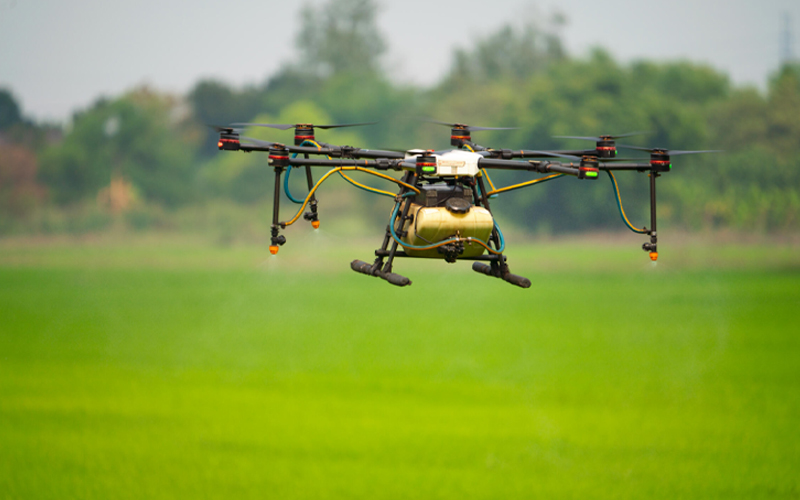
Edge GIS telecom drone LiDAR enables remote capture of high-resolution spatial data for telecom site surveys. This supports near-real-time validation and analysis for network planning and maintenance while reducing the need for repeat site visits.
Industry adoption is accelerating. The global inspection drone market is projected to reach USD 12.34 billion by 2032, growing at a 17.6% CAGR, underscoring the broader adoption of drone-based inspection models, including telecom inspection drones, across large-scale infrastructure environments.
Limitations of traditional telecom inspection methods
Traditionally, technicians would undertake risky climbs up to telecom towers for inspections. Even with safety equipment, the risks remain inherent. There is also the option of ground-based visual assessments, which could be unreliable. Physical access constraints, weather dependencies, and site-specific hazards often delay surveys and increase operational effort.
These approaches also limit consistent spatial data capture across sites. Ground-based inspections provide limited visibility into surrounding terrain, nearby structures, and line-of-sight conditions that influence site feasibility and network performance. This increases the likelihood of repeat visits, slows decision cycles, and introduces variability into site assessment outcomes. Telecom tower drone inspections reduce the need for physical access, mitigating these concerns.
The role of drone-based lidar in telecom site surveys
Drone-mounted LiDAR systems are increasingly used in telecom site surveys to capture detailed elevation and structural data that traditional visual inspections cannot provide. By emitting laser pulses and measuring their return, LiDAR enables accurate modelling of terrain, towers, and surrounding obstacles, supporting clearer assessment of site conditions and spatial constraints.
Compared with manual methods, telecom inspection drones equipped with LiDAR deliver more consistent, repeatable datasets across multiple sites. When combined with standardised survey workflows, this reduces reliance on physical access and improves the completeness of inspection data.
As 5G, edge computing, and IoT networks expand, LiDAR is poised to become integral to telecom infrastructure planning and maintenance, enabling smarter designs, faster builds and more resilient networks. Integrating LiDAR with AI and GIS is expected to further advance automated analysis and support increasingly complex and scalable network environments.
Edge GIS processing for real-time survey validation
As telecom site surveys generate larger volumes of high-resolution spatial data, the ability to process and validate information closer to the point of capture becomes increasingly important. Edge GIS processing enables preliminary analysis of drone-collected LiDAR data in near-real-time, allowing teams to verify data completeness, accuracy, and coverage while surveys are still in progress. This reduces delays caused by missing or unusable data and supports faster survey completion.
By integrating edge GIS telecom drone LiDAR workflows with central GIS platforms, organisations can streamline data ingestion, standardise outputs, and accelerate decision-making cycles. These workflows help ensure that spatial insights from drone surveys are quickly available for planning and validation.
Business benefits for telecom operators
As telecom networks expand and site volumes increase, operators are under pressure to improve the efficiency, consistency, and safety of inspection and survey workflows.
Key business benefits of drone telecom inspections include:
- Improved survey accuracy through high-resolution spatial data that captures terrain, structures, and surrounding constraints more comprehensively
- Faster inspection and validation cycles by reducing manual checks and minimising repeat site visits
- Enhanced safety outcomes by eliminating hazardous on-site inspections
- Greater operational visibility across distributed assets through standardised, GIS-integrated datasets
- Reduced rework and disruption by validating data quality earlier in the survey process
Operational considerations for adoption
Realising the value of drone-based LiDAR surveys and drone telecom inspections requires more than deploying new tools. Telecom operators need standardised workflows that integrate drone outputs into existing GIS environments, along with clear data validation and governance controls. Alignment between field teams, GIS analysts, and planning functions is essential to ensure consistent data quality and reliable outcomes across sites. Establishing these operational foundations helps organisations scale drone-enabled survey programmes while maintaining accuracy, compliance, and repeatability.
How can Infosys BPM help enhance edge GIS capabilities?
Infosys BPM supports telecom operators through geospatial data services that integrate drone-generated spatial data into GIS workflows. These capabilities help organisations standardise survey processes, maintain data quality, and improve visibility across distributed network assets.
By combining domain expertise with scalable delivery models, Infosys BPM’sgeospatial data services enable the reliable adoption of drone and GIS-based survey workflows aligned with enterprise operational requirements.
Frequently asked questions
Drone-mounted LiDAR captures high-resolution 3D spatial data, enabling precise modelling of terrain, tower structures, and surrounding obstacles. This improves line-of-sight validation, clutter analysis, and site feasibility assessments critical for dense 5G deployments where minor spatial inaccuracies can impact network performance.
Edge GIS enables near-real-time validation of drone-collected LiDAR data during the survey itself. By confirming data completeness and accuracy onsite, operators minimise repeat visits, accelerate approval cycles, and reduce bottlenecks across multi-site rollout programs.
Enterprise adoption requires standardised data capture protocols, defined validation thresholds, secure data transfer mechanisms, and seamless integration with central GIS platforms. Cross-functional alignment between field operations, GIS teams, and network planning units is essential for consistent outcomes.
High-resolution 3D models enable structural assessments, tilt detection, clearance validation, and vegetation encroachment analysis. When integrated with asset management systems, this supports condition-based maintenance strategies instead of reactive inspections.
ROI typically includes reduced survey cycle time, fewer repeat site visits, lower safety risks, improved data consistency, and faster deployment approvals. At scale, these efficiencies translate into accelerated network expansion and reduced operational expenditure.