Among all the technological advancements, nothing has impacted our everyday lives as much as geographical data and analytics. Whether they realise it or not, people are utilising geographical data solutions every day, from using a global positioning system (GPS) for navigation or watching daily news to seeing geographical stats and schematics around certain issues.
Geographical technologies surround us in many different forms. But geospatial technology and geographical information systems (GIS) are among the first words to come to mind while discussing geographical data solutions. Many think the two are the same and use GIS and geospatial interchangeably while talking about the analysis and visualisation of geographical data. However, despite their potential utility in mapping applications, certain nuances differentiate GIS and geospatial technologies.
What is geospatial technology?
Geospatial is a broad term referring to a collection of tools and technologies that have both geographical and spatial components. Although relatively new, geospatial is an umbrella term that covers various geographical data solutions and technologies, focusing on the context of how a data point relates to a specific geographical coordinate. Geospatial technologies acquire, store, manipulate, and visualise this data as maps for easy interpretation and usage.
Geospatial technologies rely solely on geospatial data, representing unique details about a geographical location, and can have a host of different applications. Some of the common examples of geospatial data include:
- Census data
- Geographic imagery
- Cartographic data
- Mapping coordinates
- Information associated with ZIP codes
And some common examples of geospatial technology using this data are:
- Remote sensing
- Geofencing
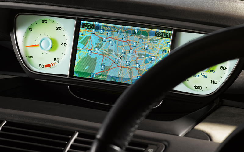
- Global positioning systems
- Geographic information systems
With advancements in computing for consumers, ease of information sharing, and access to the internet, geospatial technology is becoming readily available for everyday users, making their lives simpler. For example, a simple GPS application on a smartphone can help you easily navigate a new area, or a marketing professional can easily link demographic data with a geographical location to drive strategic decisions.
What is GIS?
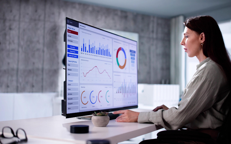
A geographic information system (GIS) is a specific geographic data solution within a wide array of geospatial technologies that integrate both spatial and non-spatial data with the help of geographic software to store, analyse, and visualise relevant information. The three key activities comprising GIS are data management (acquisition, cleaning, and integration), data analysis (spatial query, overlay, and mapping), and data representation (producing maps, charts, or graphs). This allows you to effectively capture, manage, analyse, and visualise spatial data and link it with non-spatial data.
GIS stores spatial and non-spatial information in layers, integrating them to let you locate the points of interest and understand how they connect. Integrating subject data with location data allows you to visualise relationships and glean deeper insights about your subject, which would otherwise be impossible without added layers and interactivity of GIS tools. In short, GIS gives you an additional dimension to effectively use the geographical data you have.
Difference between GSI and geospatial technologies
In short, when considering the differences between GIS and geospatial technology, the main thing to understand is that GIS is a part of geospatial technologies, but not every geospatial technology is GIS. Geospatial is an umbrella term encompassing different technologies and tools handling geospatial data, whereas GIS is a specific example within the geospatial umbrella. The confusion in GIS vs. geospatial comes from the overlap between the two, as they both incorporate a geographical element. But the specificity of the geographical component differentiates the two.
* For organisations on the digital transformation journey, agility is key in responding to a rapidly changing technology and business landscape. Now more than ever, it is crucial to deliver and exceed organisational expectations with a robust digital mindset backed by innovation. Enabling businesses to sense, learn, respond, and evolve like living organisms will be imperative for business excellence. A comprehensive yet modular suite of services is doing precisely that. Equipping organisations with intuitive decision-making automatically at scale, actionable insights based on real-time solutions, anytime/anywhere experience, and in-depth data visibility across functions leading to hyper-productivity, Live Enterprise is building connected organisations that are innovating collaboratively for the future.
how can Infosys BPM help?
Infosys BPM Geospatial data solutions address the customers’ mapping needs with the help of the latest digital technologies. With 20+ years of innovation experience and a global network of 30k expert associates, our geospatial data solutions can help you deliver lower IT costs, enhanced quality and improved availability when resolving IT or business problems across utility, oil and gas, telecom, mining, transport, and services industry segments.