


Geospatial Data Services
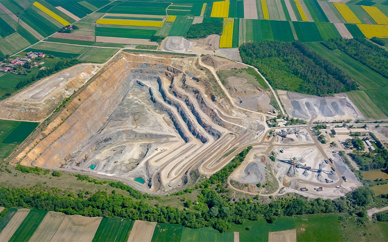
Infosys BPM Geospatial data services apply digital technology to address complex mapping and location intelligence needs. We have been providing a range of GIS services for 20+ years for our clients globally, resolving their business/IT problems across industry segments such as Utility, Oil & Gas, Telecom, Mining, Transport, and Services through proven Infosys Global Delivery Model. Over the years, we have been involved in delivering geographic information services like mapping, collection, gathering, storing, processing, integrating, managing, analysing, and distributing map data. We have been focusing and investing heavily on project-ready GIS to cater to sudden demand surges and routine challenges from our clients with respect to provisioning, outage, field/fleet operations, disaster, data quality, and so on.
These enterprise-grade geospatial data services help leaders improve asset visibility, optimise field and network operations, and respond faster to outages, demand surges, and regulatory expectations.
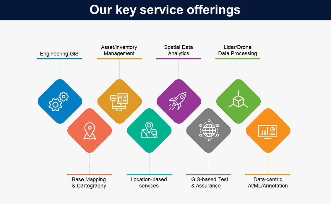
Infosys BPM has a proven GIS Centre of Excellence (CoE), which offers services such as:
Offer expert guidance to organizations in implementing and optimizing Geographic Information Systems (GIS) tailored to their specific industry needs.
Key components
- Assessment: Evaluate the client's current geospatial capabilities and identify areas for improvement.
- Strategic planning: Develop a roadmap for GIS integration aligned with the client's business objectives.
- Technology selection: Recommend appropriate GIS tools and platforms that fit the client's requirements.
- Implementation support: Provide assistance during the deployment of GIS solutions to ensure seamless integration.
Manage and maintain geospatial data to ensure accuracy, consistency, and accessibility for informed decision-making.
Key components
- Data collection and entry: Gather geospatial data from various sources and input it into the gis system.
- Data cleaning and validation: Ensure the geospatial data is accurate and free from errors.
- Database management: Organize and store geospatial data efficiently for easy retrieval and analysis.
- Data integration: Combine geospatial data with other datasets to provide comprehensive insights.
Provide ongoing support and maintenance for GIS applications to ensure optimal performance and user satisfaction.
Key components
- Technical support: Offer assistance to users encountering issues with GIS applications.
- System monitoring: Regularly check the health and performance of gis applications to pre-emptively address potential problems.
- Updates and upgrades: Keep GIS applications up-to-date with the latest features and security patches.
- User training: Provide training sessions to help users effectively utilize GIS applications.
Analyse geospatial data to uncover patterns, relationships, and trends that inform strategic decisions.
Key components
- Data visualization: Create maps and other visual representations to illustrate geospatial data insights.
- Spatial modelling: Develop models to simulate real-world scenarios and predict future outcomes.
- Trend analysis: Examine geospatial data over time to identify significant changes and trends.
- Reporting: Generate comprehensive reports detailing the findings from spatial data analyses.
Oversee GIS projects from inception to completion, ensuring they meet client requirements and are delivered on time and within budget.
Key components
- Project planning: Define project scope, objectives, and deliverables in collaboration with the client.
- Resource allocation: Assign the necessary resources, including personnel and technology, to the project.
- Timeline management: Develop and monitor project schedules to ensure timely delivery.
- Quality assurance: Implement processes to maintain high-quality standards throughout the project lifecycle.
To deliver these services, we leverage GIS tools such as:
- AutoCAD — Map 3D
- Esri suite of products — Desktop and Enterprise
- GE Smallworld
- G-Technology
- Third-party COTS products built on Esri suite (Schneider ArcFM, Geocortex, Epoch Software, Geofield)
The core competency of Infosys BPM lies in delivering various asset management solutions pertaining to data digitisation, data creation, data migration, spatial modeling, and analytics.

Insights


Why choose us for geospatial data services?
Infosys BPM GIS services team possess experienced and highly skilled domain experts with spatial technological background to resolve major challenges across industries. The geospatial data framework operates on a co-creation model built to exceed every requirement and expectation from our clients and partners — data/solutions/integration — and with effective automation delivering lower IT costs, improved availability, and enhanced quality.
Our geospatial data services are delivered by experienced GIS domain experts with deep spatial technology backgrounds who can address large-scale asset, network, and field operations challenges across industries.
How do we deliver value?
Infosys BPM addresses challenges from the clients and delivers processes and strategies in the geospatial ecosystem through:
- A network of more than 30k associates across 10 global locations to deliver measurable benefits to organisations.
- Domain expertise, innovation, and industry experience of 20+ years.
- Long-term and sustainable model with leading navigation industries.
- Competence in working with all industry-standard data models across all phases including design, development, customisation, and implementation.
- Focused technology practices with a global delivery model, integrated domain excellence, and complete project turnkey solution and ownership.
- Expertise in data migration/data load, extensive asset management, value-driven infrastructure, and test automation.
- Industry collaboration and institutional partnerships to derive best practices.
Our Geospatial Data Industrial offerings solutions


Expertise, innovation & experience
Success Stories
Bringing values to businesses through our products and services

Case Study

Case Study

Case Study

Case Study
Challenges and solutions
Centralised GIS consulting, spatial data management, and spatial analysis services consolidate asset and network data from multiple sources into a single geospatial view, enabling faster planning, maintenance, and outage response.
Structured spatial data management services—including data collection, cleaning, validation, and integration—help maintain accurate, consistent geospatial datasets that can reliably support analytics, field operations, and regulatory reporting.
Application support, maintenance, and project/program management services provide ongoing technical support, monitoring, upgrades, and delivery governance so internal teams can focus on business priorities while GIS platforms and projects are run at scale.
Request for services
Find out more about how we can help your organization navigate its next. Let us know your areas of interest so that we can serve you better

All the fields marked with * are required
