Imagine a delivery fleet that dynamically reroutes itself around traffic jams along the most fuel-efficient routes, or a telecom operator that proactively reallocates higher bandwidth to a neighbourhood where a sporting event is likely to cause network congestion. What if real-time site scans could detect and alert on layout deviations and potential risks?
These are no longer futuristic possibilities, but real-world scenarios enabled by AI-powered geospatial applications that connect and analyse multiple streams of data in real-time.
From static maps to predictive insights
Location intelligence, which derives meaningful insights from geospatial data, is already guiding enterprises to make timely and smart interventions. It is firmly embedded into many business intelligence systems, enabling enterprises to visualise assets, monitor changes in physical environments, and optimise operations accordingly. These systems now work with multiple integrated data sources, advanced AI-powered analytics, and visualisation techniques, to help enterprises go beyond merely understanding what is happening. They predict future events and recommend actions to help enterprises avoid disruptions altogether. GeoAI drives this evolution, thus fundamentally changing how enterprises interact with the physical world.
The rise of living world models
The traditional Geographic Information System (GIS) service models relied on snapshots of spatial data and analysis, which were mostly static. But today, GeoAI works with ‘living world models’ fed by real-time data from IoT sensors, satellites, drones, etc., to create constantly updated images of the physical world. Such digital twins are slowly blurring the lines between the digital and the physical worlds. Digital twins are already transforming industries by simulating and evaluating real-world scenarios before the actual implementation. A recent Eagleview Technologies report, The Future of Geospatial Intelligence, notes that digital twins are evolving into operational decision-making interfaces that continuously integrate with the physical world.
Enterprise decision-making changed forever
Powered by AI, geospatial systems are becoming reasoning partners in human decision-making by recommending actionable insights. This shift is enabled by the convergence of satellite imagery,edge computing, and a host of other technologies. New service models are emerging across industries as they reimagine use cases with changed outcomes. Gartner projects Earth Intelligence to become a nearly $20 billion revenue opportunity for technology and service providers by 2030.
According toGartner, Earth intelligence involves applying AI to earth observation data to deliver industry-specific solutions. This prediction underscores the immense possibilities of AI-poweredgeospatial enterprise applications.
Additionally, the emergence of cloud-based platforms, Natural Language Processing (NLP), and agent-based interfaces has significantly enhanced access to geospatial analytics. This democratisation enables a wider range of users to query the system conversationally and explore complex questions around the what, why, how, and what-ifs. Also, technological advances such as Very Low Earth Orbit (VLEO) satellites are enabling the capture and access of real-time geospatial data with amazing granularity, frequency, and affordability. This growing access to a plethora of data from satellites, sensors, and drones through options such as geospatial data as a service, is further fuelling industry-specific applications.
Here are a few key use cases across industries to understand how location intelligence is impacting the outcomes.
Supply chain and logistics
AI-powered geospatial applications boost efficiency by using predictive routing that analyses weather, traffic, and historical performance data to anticipate delays. These systems also proactively alert customers about their shipments. Additionally, relevant insights help enterprises plan their workforce more effectively and determine optimal warehouse locations for improved delivery lead times. GeoAI is also helping enterprises strengthen traceability and sustainability compliance, including requirements under regulations such as the European Union Deforestation Regulation (EUDR) and the UK Environment Act.
Energy and utilities
Predictive maintenance powered by real-time geospatial monitoring helps reduce operational costs and prevent outages. Insights derived from energy consumption patterns enable utilities to improve demand forecasting, enhance grid efficiency, and schedule maintenance with minimal service disruption. Oil and gas exploration teams can reduce risks and improve drilling precision by using seismic and satellite data through GeoAI-powered modelling. Pipeline operators can monitor environmental risks and prevent or minimise leaks by opting for geospatial mapping services.
Urban planning services
Location intelligence isenabling smart cities by reducing traffic congestion and emissions, while improving customer experiences through real-time alerts of public transport schedules. Urban services such as waste collection and emergency response benefit from route planning and compliance tracking.
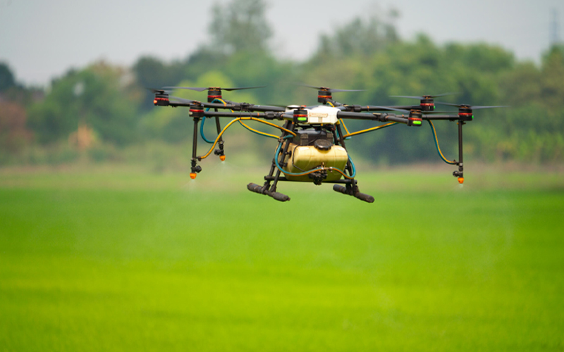
Agriculture
Location intelligence is aiding smart farming by analysing soil moisture and weather data to optimise irrigation schedules. It aids water-efficient farming and mitigates pest attacks with its predictive capabilities. Livestock sensors help farmers track their livestock and understand their behaviour.
Other than these examples, virtually every industry, from insurance and healthcare to telecom and financial services, is now exploring the growing potential of location intelligence. The future of location intelligence will be decided by how effectively enterprises convert the geospatial complexity into business clarity that drives their actions. Ultimately, the goal is not merely to visualise the world, but to help enterprises navigate uncertainty itself.
How Infosys BPM can help
Infosys BPM’sgeospatial data services include GIS consulting, spatial data management, application support and maintenance, and spatial data analysis. Our domain experts have been addressing challenges related to large-scale assets, field operations, and networks across industries. Over 20 years, we have built a robust geospatial ecosystem that combines deep expertise, sustainable models, technology best practices, and industry and institutional partnerships.